2025 Around Scotland - 2
The Outer Hebrides and The NC 500


You're now on this page
In April and May 2025, we cycled around Scotland.
This page is part 2 out of 4 and covers the 3th and 4th week of our trip, from the Outer Hebrides to the Highlands up to John O'Groats.
If you missed the introduction or any of the previous pages, you can click on one of the hereunder displayed maps to go to the respective page.
If you would like to receive the zip file of the GPX track of our complete trip, please send a request to: dilistuffmail@gmail.com
Video on DILISTUFF
YouTube channel


The daily "Morning" shoot.
Every morning, Linda takes a "Morning photo" before we jump on the bike or go out for a walk.
At the bottom of this page (menu item: Where, when and how), you'll find for each of these photo's where we stayed that night, where we cycled to, how much km's, in which location we had something to eat or snack and where we did our grocery shopping.


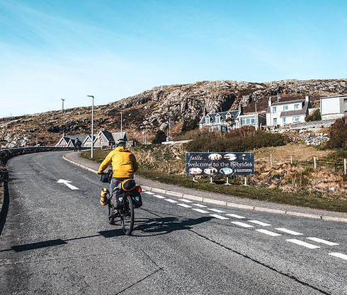
Outer Hebrides
From Vatersay to Berneray


The journey Oban to Castlebay on Barra island takes a little less than 5 hours. The first hours, you're sailing via the Sound of Mull to reach the Atlantic Ocean.
We were lucky that we bought our tickets the day before in the Oban ticket office.
Actual sailing times were different from those published on the Calmac website.
When we boarded, we met a cyclist who had the same problem the day before and missed his departure.

Arriving in Castlebay around 4 pm, we're immediately on our way to Vatersay island, the start point of the Hebredian cycle way.
Tomorrow, we have to cycle back via the same road. It's only 9 km to the Vatersay community center where you can "Wild camp" but have access to the toilet facilities of the community center.
Something like "Best of both worlds".


We're finding the perfect camping spot just next to the Traigh a Bhaigh beach.
It's a good 100 meters from the community center which also has a café.
Unfortunately, the café is only open between 10 in the morning and 4 in the afternoon. Pfff..., we arrived after 4 and need to be on our way before 10 to catch the next ferry between Barra and Uist.
A good thing, the toilets and a place to do your dishes are open 24/24.


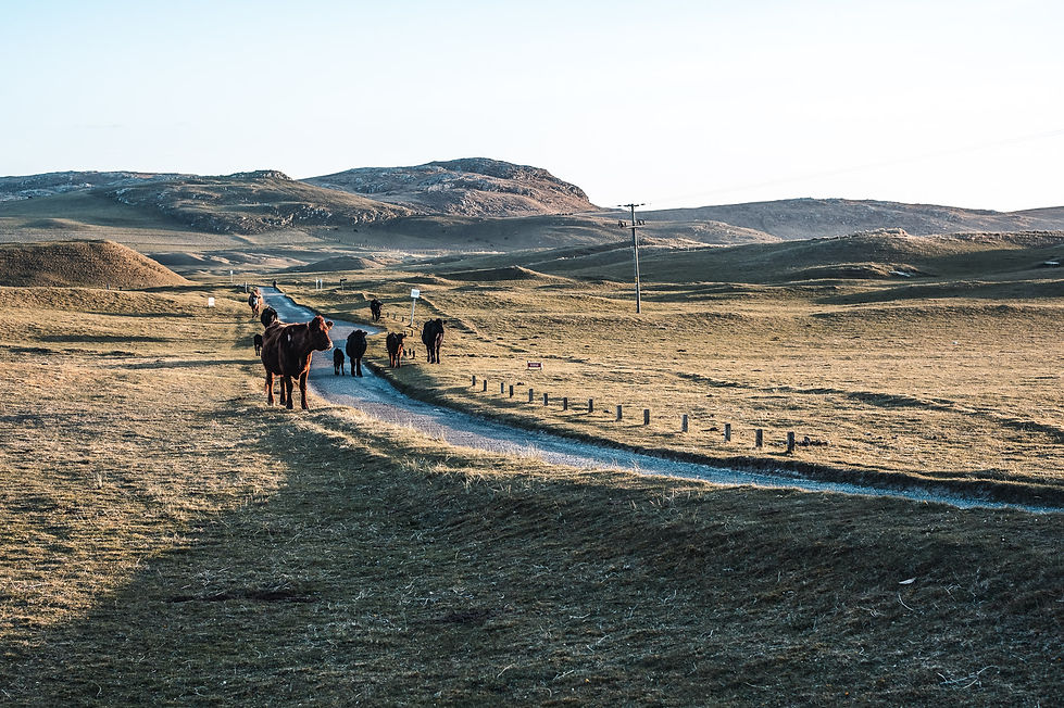
Cows roam freely on the beaches and coastal grasslands of Vatersay. They're often seen on the beaches and while there is no specific place they go for the night, they're always on the road with sundown.
It's mid April and the temperatures in the morning are still very low. Good that we brought our bigger tent with a vestibule. We can cook breakfast and eat in the tent, out of the wind.


There are only 5 sailings per day between Barra island and Eriskay. The 3rd sailing is at 11.10 am, the next is nearly 5 hours later. It means, the 11.10am sailing is the one we need to take. First depositing some money in the Honesty Box for the use of the toilet and we're on the road.


The Hebridean way goes from the isle of Vatersay to the Isle of Lewis. There is a 298 km cycle way and a 251 km walking way.
The entire route is spanning 10 islands, using 6 causeways and taking 2 ferries.
The outer Hebrides are considered to be the traditional heartland of the Gaelic language. Total area is around 3.000 square km and they have a population of around 26.000 inhabitants.
With so few inhabitants, you need to plan ahead for buying your groceries as shops are not widely spread. Certainly a challenge on Sundays when most of shops and eateries are closed.


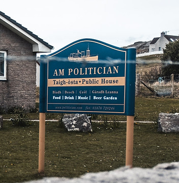
As it's around lunchtime, we decided to have lunch in "Am Politician" where we meet the 2 again, this time telling us the story of the pub.
The pub is named after the SS Politician which sank in 1941 en-route to Jamaica in the Eriskay waters. All crew was saved and the islanders helped themselves to the cargo, some 40.000 cases of Scotch whisky before the winter weather broke up the ship.
No islander considered this stealing as they were only salvaging what otherwise would have been lost to the elements.
The pub still has some of the original bottles.
While we were waiting for the ferry, we're meeting 2 English tourists visiting the Outer Hebrides by campervan.
They are always spending their holidays in the U.K and already made a reservation for dinner in the only pub of Eriskay, "Am Politician". They have requested to stay overnight on the pub's private parking.
Wild camping is allowed in Scotland for travellers with no or non motorised vehicles only.


An 1.6 km causeway connects Eriskay with South Uist, being the second largest island of the Outer Hebrides.
While it has not been raining today, the wind has been increasing and it's right in our face. With gusts of 50km/hour, we decide it's a good idea to stop early today.

In the Outer Hebrides, there are 5 times more sheep than human beings.
20 years ago, it was even a lot more but the cost of keeping sheep on the islands is far more expensive than on the mainland.
Higher costs of fertiliser due to poorer quality of the land, much higher transport costs of everything required, etc..


Yesterdays decision to stop early was not the best decision ever. Yes, we were happy to be inside with the strong winds and predicted rain. No, the price for 1 night was overpriced. The only available room was coming with a price tag of 210 euro per night and we were as such expecting a posh hotel. That did not happen, we can not say it was bad but we certainly thought it was overpriced. Similar like in Arran, an example of high prices when there are not a lot of options.

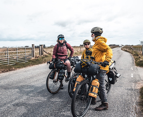
We're now 14 days on the road and it's the first time we're meeting bikepackers who seem to travel in a similar way as we do. They are also cycling the Hebridean way but in the other direction.


While hotels, restaurants or supermarkets are most of the time only available in the few bigger cities, most of the villages have a community center or crafts center where you can buy some essentials and local crafts. Often, these community centers are manned by volunteers who take turn on a regular basis. When travelling by bicycle, there's not much you can buy but the bonnet in Shetland wool was very tempting.

Cycle day 14 went very smooth, the biggest climb was 30 meters up. We've cycled 76 km and we're now a couple of islands further in North Uist. Time for camping again to compensate on yesterdays bill.


It's still very cold at night but we are now well prepared. Socks, extra clothing and a hood. (Did you notice Linda's new one)
When we get up in the morning, our neighboor tells us that there was a layer of ice on his tent when he went to the bathroom early in the morning.
We still have some instant hot cacoa and decide that this will be the better choice for a chilly morning.

Today, we're taking the ferry to Lewis & Harris. Checking the sailing times, there are again only a few sailings per day and we should be able to catch the sailing of 1.30 pm. It's about 32 km, time enoughs. I (dirk) decide not to tell Linda as otherwise, we will just be racing again as from the first km "to be in time".


Of course, there are some challenges like the Scolpaig tower which is one of the most photographed sites on the island,
or this mobile coffee shop with nice pastries, or these picturesque houses, or these cute sheep begging for taking a photo, or .....


After awhile, Linda starts noticing that after we had stopped for coffee, I seem to be cycling a lot faster than usual.
Any reason for this ?
When I explain, we both go full throttle and we are arriving at the Berneray Ferry Terminal about 30 minutes before scheduled departure.
Lucky again as the ferry left 20 minutes before schedule. All pre-booked passengers have boarded and they also expect bad weather.
No need to wait.
On the ferry, staff tells us that the next couple of days, the weather will get worse. According to their weather predictions, this afternoon, wind will be increasing and tomorrow, there will be a lot of rain.
He recommends that if possible, we look for a nice place to stay inside this evening and tomorrow.
Checking our map, first place with some affordable lodging is Tarbert, another 34 km to go.

Outer Hebrides
Lewis & Harris

When talking to other travellers, it seems that Lewis & Harris are the most beautiful islands of the Outer Hebrides. It means that we really should take our time to visit and we decide to already make a reservation in a B&B in Tarbert for tonight. No reason to hurry as we have a confirmed place to sleep for tonight. The B&B is available for 2 nights and there are still other options in Tarbert. When we arrive, we can still decide on the spot if we're staying in this one for 2 nights.


The first 22 km are mainly along the coast line, gently going up and down.
The views are breathtaking and we just have to stop around every corner to capture the views.
We have never been in the Caribbean but we've of course seen pictures. The sea and beaches here look like being there.
Pristine and desolated.
Suppose the only thing missing is a warmer temperature.


After the Sound of Taransay, the only climb of the day starts and the view of the mountains and the many lochs creates a different experience.
wind
We're still having some picnic left overs and when passing a bus shelter, somewhere in the middle of nowhere, thats certainly the best place to also hide for the wind.

Arriving at the B&B, it started to rain and we're happy to be inside. Surprise: as a welcome drink, there is a carafe of Glenmorangie whisky, just enough for 2 drams.
John, the owner is very organised and immediatly checks what we want to have for breakfast, what time, etc..
The village is a few miles away and he will drive us to the one and only restaurant and pick us up afterwards.
What a service.
Oh yes, we immediately booked for the 2nd night. (which came with a refill of the whisky)


Also breakfast is not typical Scottish, the John Special fruit salad and a Bento box.
The previous day, we got a big list to choose from what we wanted in our individual box.
John prepares and grows as much as possible himself.


Next day, it's indeed raining cats and dogs. Still good enough for a walk to Tarbert and returning via a walking trail.


After our restday in Tarbert, we're happy to see that it stopped raining and we're ready to go.
It's sunday, so it will be very difficult to find anything open. Only the big supermarkets do not close on a sunday and the next one is in Stornoway, 2 days cycling from here.
No problem, yesterday we bought enough to survive for the next 48 hours.


Nothing open, also nearly no upcoming traffic, except sheep of course.

Also time enough for a bikepacking.com photo.
That's what Linda says to describe some of these typical photo's : a cool chick, standing behind her fully loaded bike, looking straight in the camera lens.
It did not work yet, we've not been discovered yet.
Maybe she should not smile.
Maybe we're a little too old or too slow.
Who knows?
As expected, everything closed, no food, no coffee, but ... a stone to sit on. Who complains. Not us.


We're passing the Memorial to the heroes of Lochs. Lochs refers to the area's name and it commemorates the land struggle between rich landowners and crofters, chased away to make way for deer hunting estates.


Just after Loch Achmor, we found a B&B with kitchen to prepare our own dinner.
Tomorrow, last day cycling on the Outer Hebrides and there's a lot to see.

First stop are the Callanish Stones, an arrangement of standing stones placed in a cruciform pattern with a central stone circle. The stones were erected around 2.750 BC, pre-dating Stonehenge, and were used for ritual activity.
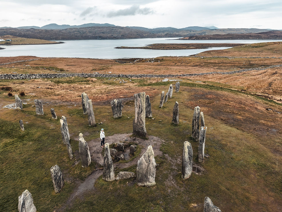

There are several sites in the neighbourhood with standing stones but the one near the visitor centre is certainly worth visiting. Just need to make a 2 km detour from the Hebredian cycleway.
Back on the Hebridean way, it's about 13 km to the Gearrannan Blackhouse village.
People lived in the village till the 70's when the last elderly residents moved out to new accomodation that did not need maintenance of thatch and stonework.


Entrance to the village is free. For the small museum, you need to pay a fee (In our opinion not really a must do).
Part of the houses is now also used as accommodation and can be booked directly on their website.

A little more than 8 km from the Black Village, you're passing the Whale Bone Arch. In 1920, the corpse of a huge blue whale with a harpoon in it's head drifted into Bragar bay. The corpse began to rot and the villagers had to deal with it.
The local postmaster thought the jawbone would make a nice addition to his gate and so it happened.
It still stands here with the harpoon hanging down from the top.


In Barvas, you're taking a right turn direction Stornoway and this is for 18 km the most boring and uneasy part of the entire trip. You're going on the A857 in one straight line to Stornoway.
Just like any other road in the Hebrides, there is no seperate cycle path but here, cars are going much faster and do not always respect the mandatory distance between car and bicycle when overtaking.
We were here mid april so there was not a lot of traffic. We can imagine that it will be different in the summer months.


Few days ago, Linda received a direct message on her instagram recommending to go for coffee and cakes to the HUB in Stornoway.
So here we are, 5 minutes before closing time but still very welcome.
Here, they also suggest to try the HEB hostel in Stornoway if we have no place to stay yet.
Good idea.


Lucky again, the Heb hostel is in the center of Stornoway and has still 1 room for 4 at the price of a room for 2.


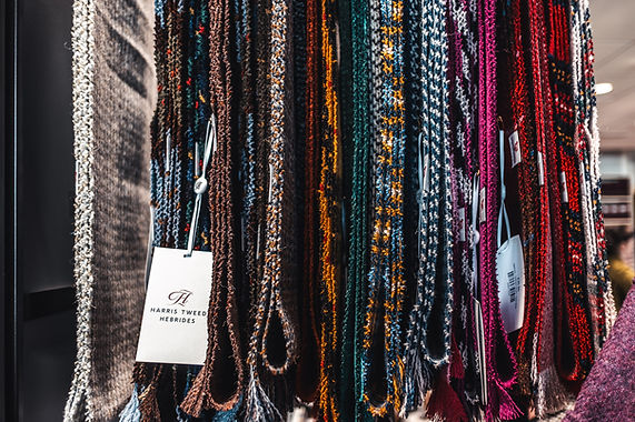
All Harris tweed is dyed, spun and handwoven by islanders of the Outer Hebrides.
As our ferry from Stornoway to Ullapool only leaves in the early afternoon, we have all the time to visit 1 of the weavers who is using a bicycle pedal powered loom in his garage.


Very tempting to buy something and far to heavy and bulky to carry around on the remainder of the trip.
Of course, they can send to your home address but what with transport, duty, etc.. . Better buy online when we really have a need for it.


We're taking the 2 PM sailing which will get us to Ullapool in 2 hours, 40 minutes.


This means, still enough time for a nice coffee and a "Pasteis de Nata" in The Blue Lobster at Cromwell street Quay.


Ready for the second to last ferry during the trip. The only one left is the way back to the Netherlands or Belgium.


NC 500 - The Northwest Highlands
From Ullapool to Durness


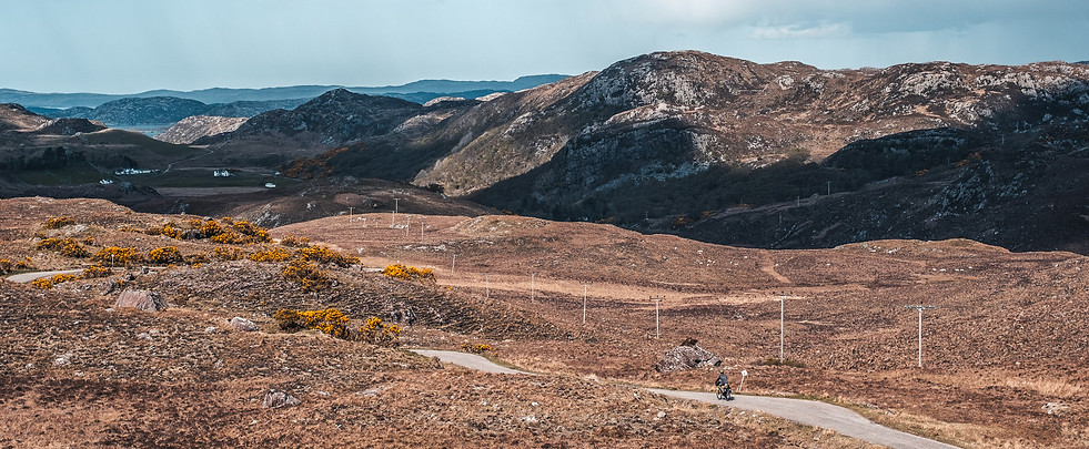
When we are arriving at the Ullapool port and we're looking around us, it is clear that the next couple of days may get a little tougher.
Wherever we look, it's all mountainous.
We can already see the campsite when we're entering the harbour.
Ullapool is a fishing village, known as the gateway to Lewis and Harris and a stop on the North Coast 500.
From here up to John O'Groats, our bicycle track will most of the time follow the NC 500.
After pitching the tent, we already go to Tesco for our grocery shopping and when we see the blossoming trees, it's clear that spring is now really in full swing. We just hope the midges don't know it yet.


While campsites are not really widespread, we have to say that most of them are in a prime location when it comes to the view. Also here in Ullapool, it's just amazing and we suppose that we are just lucky to be here in the low/mid season as the nice spots are most of the time still available.


Before hitting the road, we first went to Ullapool Outdoors for a replacement gas canister. As far as we can see, this is the only outdoor gear shop for the next 2 weeks, till we're in Inverness.


Todays target destination is Lochinver. There is a hostel in Lochinver offering a double bunk bed. It seems you have the entire room for yourself if it's not very busy. Alternative is a hotel in Lochinver or a campsite some 10 km further in Achmelvich.

From pretty far away, you can already see the Stac Pollaidh, which translates to peak of the peat moss.
The Stac Pollaidh is a Graham, a mountain in Scotland with a height between 2.000 and 2.500 ft (between 610 and 762 meters)
In Scotland, mountains higher than 3.000 ft (914.4 meters) are classified a Munro, named after Sir Hugh Munro who compiled the first list of such peaks in 1891.
Those between 2.500 and 3.000 ft are classified as a Corbett.

We're having our picnic at the carpark near the Stac Pollaidh.
This is the starting point for a hiking circuit around the Stac Pollaidh with an optional ascent up to the ridge.
The walk is around 4.5 km and will take between 2 and 4 hours.
The easiest way to get there is of course by car but there also seems to be a bus (811) from Ullapool.


Arriving in Lochinver, the An Cala Café bunkhouse reception was still closed and we first checked the price of the Culag hotel, 150 meters further. At 180 euro's for 1 night, this was not what we were going to do.
At 5 PM, the staff of the Café arrived and we were set for 60 euro's. No other guests in the room.


When we started plotting this trip, we copied a GPS track of Hans van der Veecken. Hans decided to follow the main road (A837) to Scoury instead of the more scenic and hilly NC500 (B869), mainly to avoid the heavy NC 500 traffic on single track roads. As we are still in the low season, we decided for the scenic route but recognise that in the summer months, it must be a real challenge with all the passing campervans.
After breakfast in our hostel and a nice cup of coffee in the Lochinver SPAR, we were ready to go for what turned out to become one of the most scenic parts of our trip.


It's a downhill, I (Dirk) usually let go and the distance between Linda and myself increases.
With an uphill, the same happens but it's usually the other way around. Linda is a good climber and I have too much of my own weight holding me back.
Reaching Flossie's beach store in Clachtoll and looking behind, no Linda in sight. Suddenly I hear her screaming for help. When riding up the hill again, she slowly arrives, all shaking.
While she was looking around admiring the sights, she rolled in to a large pothole and crashed. Fortunately, just some bruises and a scary experience.
Stopping at Flossies to recover from the tension, we're meeting Jean-Luc for a second time.
Yesterday, he took some photo's of us and he spoke a few words with Linda.
Jean-Luc lives in Paris and is on a photoshoot holiday in Scotland while his wife is visiting their daughter in Corsica.
It's mainly a matter of weather. He does not mind some rain while his wife does not mind the sunshine.


Today, we cannot stop being overwhelmed by the landscapes. We're riding from one picture perfect place in to another one.
It's also the first time of the trip that I had to push my bike instead of pedalling up.
For Linda, it's always easier to pedal up as she is stronger in the legs. For me, pushing is easier when it's too steep.


The Scoury campsite is again the perfect place to pitch the tent. Wonderful views from every pitch, a supermarket (SPAR) with a bar onsite. Kitchen facilities with kettle, fridge, microwave, etc.... Everything you need, except .... no electricity for tents. This is something which we started encountering since we're back on the mainland. It just means we need to find someone in a campervan who is willing to charge our powerbanks during the night. Also not a problem.


And there it is, the first signboard to John O'Groats. 191,5 km to where we officially pick up the North Sea cycle route and the second half of our trip.

The good thing about cycle touring is that whenever you see another bikepacker or tourer, you stop to have a chat. That's how you meet the most unusual and interesting people. Patrick lives in London but keeps on coming to this part of Scotland to find his inner peace. He knows this area like his backyard and explains to us the different microclimates around.


Today was an easy day compared to the 2 previous, 42 km and 1 decent climb only. Arriving in Durness, we're again surprised with the scenic spot on our campsite, this time with a private beach and lookout point.
Tonights dinner is roasted raisin bread with baked Halloumi cheese and sauteed baby tomatoes.


NC 500 - The Far North Highlands
From Durness to John O'Groats


It has been raining tonight and we stay a little later on the campsite to let the tent dry. It's about 160 km to John O'Groats and we will most probably do this in 3 days. There is a campsite on the grounds of the youth hostel in Tongue, some 48 km's from here. We'll decide what we will do when we're there, hostel of campsite, depends on the weather.


The Smoo cave is 3 km from last nights campsite and is a popular tourist spot. The sea cave is set into the limestone cliffs and can be explored by boat or by path. The cave has one of the largest entrances of any other sea cave in Britain. It was formed by a burn that runs down into the rear chamber, as well as erosion caused by the sea.
With our bikes fully packed and no save place to store them, we decided (again) that this would be a place to visit another time.


Today, we're cycling around Loch Eriboll, a 16 km long sea loch which has been used for centuries as a deep water anchorage, safe from the stormy seas.


At lunchtime, we're at the furthest point of the loch where the small river Polla flows in to the loch.
Weather prediction for the next couple of days is overcast weather, temperatures around 15 degrees celcius.
That means we can buy some dark chocolate to eat with our breadrolls without having to worry that it will melt.
Dark pure chocolate is not very common over here and most of the racks in the supermarkets are filled with milk chocolate variations by Cadbury.


Continuing via the east side of the loch, we notice the difference in landscapes between both sides of the loch. While the west side is a rocky barren coast, the east side is mainly green fields.


The North Coast 500 road trip is often done with rented vehicles and it's not only modern campervans.
Other types are mainly sportscars, verry often Porsches, retro busses like the old VW California and last but not least 4 wheel drive SUV's with a roof top tent.
Oh yes, they all stop at a passing place to let us through.


At the end of the causeway across the Kyle of Tongue, the Youth hostel does not have availability of private rooms and the campsite seems deserted.
Checking prices of hotels in Tongue, the only option is the Tongue Hotel at 250 euro for 1 night. Oeps.
Fortunately, there is still a more affordable room in Borgie, some 12 km further down the road.
Passing the Tongue hotel, we still decide to stop for a hot chocolate and guess who's walking out of the door, Jean-Luc, 3rd time we're meeting him.


The Borgie Lodge hotel is about 1 km from our track and when we arrive, Andi comes out to greet us. She looks at us with our semi-wet, slightly dirty cycle clothing and suggests to wash our stuff overnight. Seeing our hesitation, she immediately says we do not have to worry as she knows how to do this.
We're not sure as nothing is mentioned about how much we will be charged for it. Difficult.
I ask how much she will charge and Andi replies, minimum 1 pound for 1 sock. Ok, she's joking.
We bite the bullet and surrender everything we have been wearing in the last 3 weeks. Let's hope.

Of all the hotels during this trip, the Borgie Lodge is our favorite. The very personal welcome, the best food we had in a hotel, the funny and warm way of communicating by all staff.
And yes, the next morning, we got back all our cloths, perfectly washed and dried. All for free.


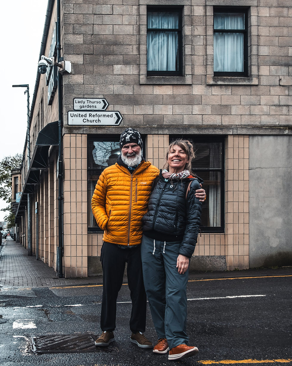
After a nice breakfast, we're on our way to Thurso. We have already booked a hotel in Thurso for 2 nights. Tomorrow, we're taking a rest day. No cycling.


Andi told us that a few km down the road, we will pass a pink box with the nicest cakes around.
Donna started this initiative after her 2 young kids asked her if they could start a business to earn some money for buying the horse and dog they dreamed of.
Donna who runs a small cake business offered as a compromise to set up the pink cake box
With the support of locals and all the tourists on the NC500, this is now a booming thing.


We're now cycling on the NC 1 or the North Sea cycle route to John O'Groats. If we want to cover the entire NSCR, we need to return the same way to Tongue after we have reached John O'Groats. That's about 100 km on exactly the same road. Not sure if this is what we want to do. Our first option was to follow the Great Britain divide up to Altraharra where we would join the NSCR. From our experience over the last couple of days, it now seems a little difficult with all the luggage we are carrying. Time will tell.

It's sunday and we entirely forgot to do grocery shopping yesterday when we were passing Tongue. Fortunately the Betty Hill General Merchants store is open. When Rafey finds out that we want something "healthy", he's immediately becoming Linda's friend. He lives very sober, no alcohol, mainly vegetarian food which he cooks himself, etc.. Unfortunately, that's not really what he is selling in his shop so we end up with just a few rolls and some fruits. Enough for our lunch as we still have some speculoos in our bags.


Whenever it rains or with too much wind, our standard stops for lunch or a snack is usually a bus stop shelter.
Shortly before noon, it started to drizzle. Not wet enough to change in to full rain gear but the combination of cooler temperatures and wind surely made us wear our goretex jackets.


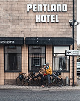
The only reason for taking a day of rest in Thurso after 5 days of cycling was because the next possible stop was another 5 or 6 days cycling away. I also had been struggling a little with a teary and irritated eye and was hoping to find a pharmacy with some good eye drops to help me out.
It takes an hour to walk around the village and we spend most of the time in relaxing, catching up with the clean up of photo's and video's, drinking coffee, eating cakes, etc..


Between Thurso and John O'Groats, the North Sea cycle route follows another track than the NC 500. While the NC 500 never bothered us when we were on the small single track roads, it now becomes more busy as drivers are less cautious when they have more space to overtake us.


It's only 40 km today and mostly flat.
First, we go to the Duncansby head for a traditional photo at the lighthouse. We're kind of disappointed as it's really a rather little lighthouse.
Agreed, it's on a high point and no reason at all to make it taller.

From the lighthouse, it's a short walk (in our case a short ride) through the fields to the Duncansby stacks. The stacks are about 60 meters high and the highest one rises above the top of the adjacent cliff.
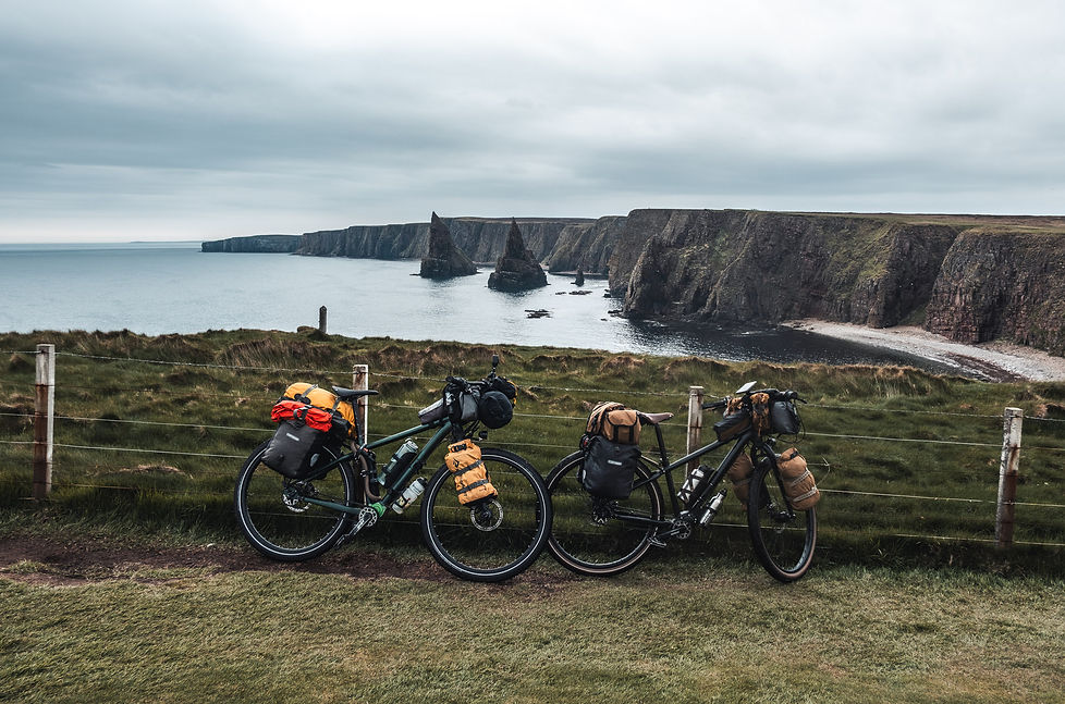


John O'Groats is best known in the cycling world as the start or end point of the LEJOG or JOGLE, a bicycle track between Land's End in the southwest of England to John O'Groats in the northeast. The exact distance depends on the chosen route and varies between 1.400 and 1.600 km.
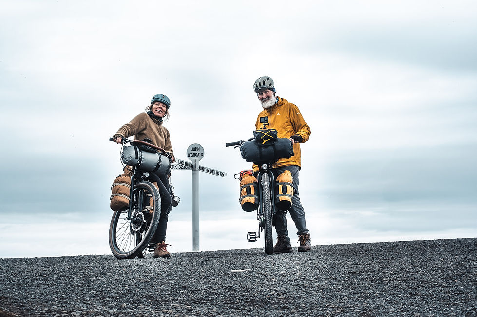


Surprise, surprise ...
Last night, I found the solution to avoid having to cycle back to Tongue via the same road, just do it in a taxi.
Via some transport operators in Inverness, I got referred to Ormlie taxis in Thurso.
Also managed to book the last room in our favourite Borgie Lodge hotel.
Obviuosly, it was not cheap to pick us up at 2 pm in John O'Groats and drive us to Borgie, but the taxi cost was probably still less than 2 days on the road and 2 extra nights of lodging.

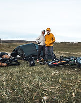
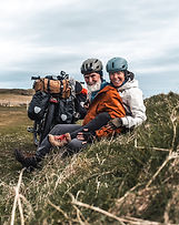
Around Scotland 2 - Favorite Outtakes
On a trip, many photo's are taken but only a small selection makes it in to the main story hereabove.
This is mainly to avoid overlap, keep it visually appealing, provide valuable content, not too short and not too long, etc...
Hereunder some of our favorite outtakes which did not make it. Click on the photo to magnify.


When, where and how.

Where:
Date:
Today:
Eat or drink:
Groceries:
April 15
MGM Muthu Oban Regent hotel
Ferry from Oban to Castlebay - 9 km to Vatersay - Hebridean way
Oban
Ferry
Where:
Date:
Today:
Eat or drink:
Groceries:
April 16
Vatersay Hall café (Wild) campsite
41 km - Vatersay to Daliburgh - Ferry + Hebridean way
Eriskay, Daliburgh
Daliburgh

Where:
Date:
Today:
Eat or drink:
Groceries:
April 17
Borrodale hotel
76 km - Daliburgh to Balranald - Hebridean way
Daliburgh, Kildonan
Daliburgh, Carnan (Lovats), Creagorry, Bayhead

Where:
Date:
Today:
Eat or drink:
Groceries:
April 18
Balranald Hebridean holidays campsite
64 km - Balranald to Tarbert - Ferry + Hebridean way
Malaclete, Leverburgh, Tarbert
Tarbert

Where:
Date:
Today:
Eat or drink:
Groceries:
April 19
Dunarain B&B
0 km
Tarbert
Tarbert

Where:
Date:
Today:
Eat or drink:
Groceries:
April 20
Dunarain B&B
55 km - Tarbert to Achmore - Hebridean way
Tarbert
Tarbert

Where:
Date:
Today:
Eat or drink:
Groceries:
April 21
Westend B&B
66 km - Achmore to Stornoway - Hebridean way
Barvas, Stornoway
Stornoway

Where:
Date:
Today:
Eat or drink:
Groceries:
April 22
Heb Hostel
1 km - Stornoway to Ullapool - Ferry
Stornoway, Ferry, Ullapool
Stornoway, Ullapool

Where:
Date:
Today:
Eat or drink:
Groceries:
April 23
Broomfield Holiday park
50 km - Ullapool to Lochinver - NC 500
Ullapool, Lochinver
Ullapool, Lochinver

Where:
Date:
Today:
Eat or drink:
Groceries:
April 24
An Cala Café and bunkhouse
57 km - Lochinver to Scoury - NC 500
Lochinver, Clachtoll, Scoury
Lochinver, Scoury

Where:
Date:
Today:
Eat or drink:
Groceries:
April 25
Scoury Caravan and campsite
42 km - Scoury to Durness - NC 500
Scoury, Durness
Scoury, Durness
Where:
Date:
Today:
Eat or drink:
Groceries:
April 26
Sango Sands Campsite
62 km - Durness to Borgie - NC 500
Durness, Tongue, Borgie
Durness, Tongue

Where:
Date:
Today:
Eat or drink:
Groceries:
April 27
Borgie Lodge hotel
60 km - Borgie to Thurso - NC 500
Borgie, Melvich, Thurso
Bettyhill, Thurso

Where:
Date:
Today:
Eat or drink:
Groceries:
April 28
Pentland Hotel
0 km
Thurso
Thurso
Where:
Date:
Today:
Eat or drink:
Groceries:
April 29
Pentland Hotel
41 km - Thurso to John O'Groats - NC 500
Thurso, John O'Groats
Thurso
This Around Scotland page is part 2 out of 4. Click here below on the respective map to go to another page of this trip.
You're now on this page